 | In the Field
IFA Excavations at Selinunte
Summary of Excavation Results, 2009
Between May and July we carried out our third campaign of excavation in the main urban sanctuary of Selinunte, opening four trenches [Figure 1].
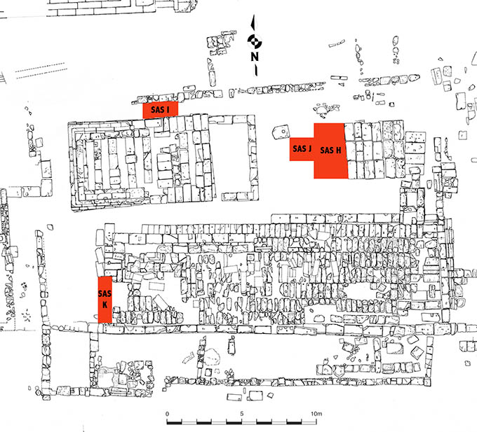
Figure 1. Area of Temple B with indication of Trenches H-K. © Institute of Fine Arts, NYU.
The largest trench was opened along the western side of the altar of Temple B (Trench H, 2.00 x 3.85 m) [Figure 2].
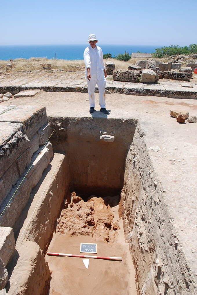
Figure 2. View of Trench H. © Institute of Fine Arts, NYU.
In this trench, the entire stratigraphic sequence was excavated, reaching bedrock in the southern half. The bedrock was covered by a red layer of earth mixed with sand, sterile, upon which was a thick (ca. 1.10 m) layer of yellow sand of aeolic formation, in which we found only a few pottery fragments of the Archaic period: it remains unclear whether this upper layer represents an artificial or, more likely, a natural formation. The top of this layer of yellow sand was marked by a series of cuts and refuse pits dating to the Early Hellenistic period. To the same period date two layers consisting of earth mixed with pottery and tile fragments, which were deposited right on top of the layer of yellow sand. The two layers are part of the same fill (dated to ca. 300 BCE by both coins and pottery), which raised the level of this area of the sanctuary of about 0.70 m. It was on this fill, and the layer of aeolic sand underneath, that the altar of Temple B was built. Our excavation indicates that the altar consists of three courses of ashlar blocks on its western face. The first course from the bottom (ca. 0.40 m h) is not neatly aligned with the two courses above, and includes a series of reused blocks. A second, small trench (Trench J, a square 1.50 m l) was opened against the western side of Trench H, in order to fully explore a large refuse pit found against that limit.
Another trench was opened against the north side of Temple B (Trench I, 0.95 x 2.25 m), near to its center [Figure 3].
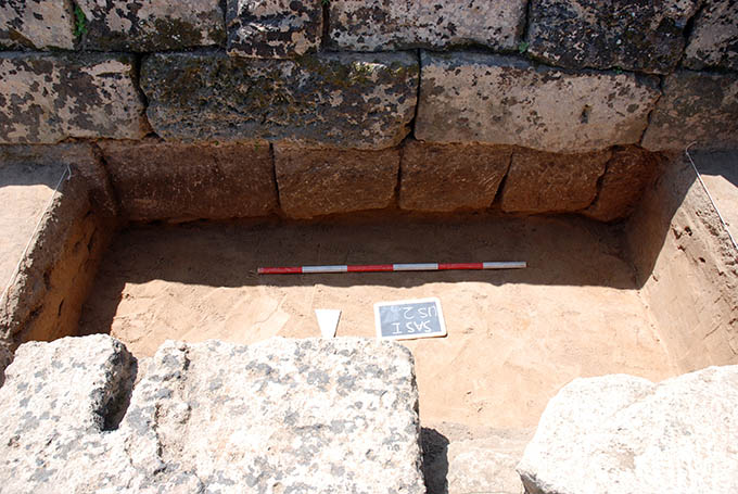
Figure 3. View of Trench I. © Institute of Fine Arts, NYU.
In this excavation, we reached to a maximum depth of only 0.20 m, uncovering two layers: a thick stratum of almost sterile sand at the bottom, and a thin stratum of earth mixed with pottery and tile fragments at the top, the latter presumably part of the same Early Hellenistic leveling found in the rest of the area. The foundation trench for the north wall of Temple B cut through both levels: pottery found in the fill of the trench, datable to ca. 300 BCE, provides further evidence for the chronology of Temple B.
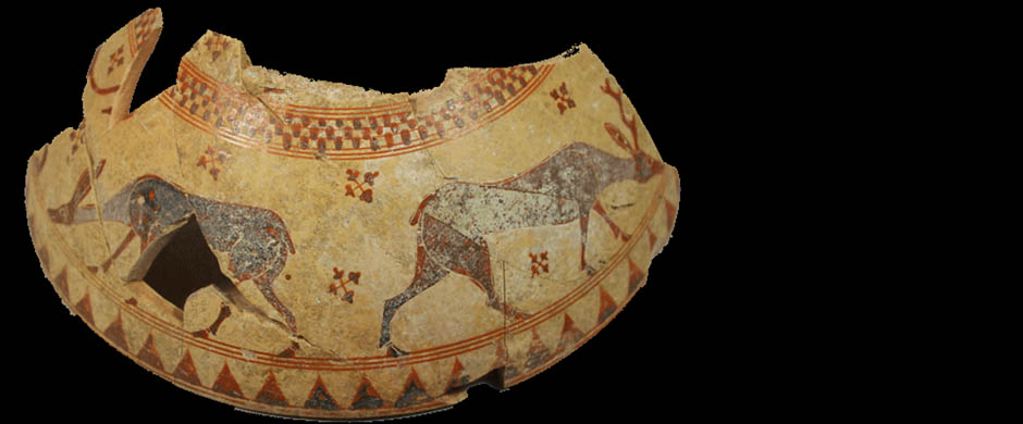
Our last trench this summer (Trench K, 0.86 x 3.10 m) was opened in correspondence to the southwestern corner of the South Building, which abuts the peribolos wall. In this trench, the entire stratigraphic sequence was excavated to bedrock. Covering the bedrock was an Archaic stratum, which included pottery datable to before the middle of the sixth century BCE. A second Archaic layer was immediately above, with pottery dated to the end of the sixth-early fifth century BCE. The South Building’s lower foundations are above this layer, which contributes to the dating of this building to the Late Archaic period. The last phase identified in our trench dates to the third century BCE, in which the South Building was systematically dismantled reusing some of its stones.
Clemente Marconi, The Institute of Fine Arts, New York University